
Welcome to Lemvig, West Jutland, Denmark..
A little about Lemvig Flying Club, the airfield, the district and some history
Lemvig Flying Club was founded in 1969 and has at present about 40 active members and about 25 junior members. The club has 6 instructors. Interested visitors are welcome - usually we fly every weekend in the summer (April/October)
Address: Ringkøbingvej 127, DK-7620 Lemvig
Phone: +45 97821368 / +45 97884380
Airfield manager and leader of flying operations: Knud Pedersen
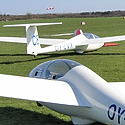
See the club´s planes.
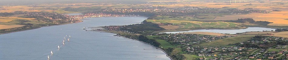
Denmark´s westernmost public airfield - both for international and domestic traffic
The airfield is owned by Lemvig Town Council and has ICAO Location Code EKLV. It is located 2,7 NM south of Lemvig (N56 30.2 E008 18.7) at 100´ / 30 meter elevation.
There is 740 x 30 meters of excellent grass landing strip, direction 08 - 26. Radio frequency 123,50 MHz. Aircraft should be parked on the grass area south of the asphalt road by the hangar. There are no landing charges. SLV info (Dept. of Civil Aviation)
Fly-in visitors arriving to visit "Lemvig marked og dyrskue", which is an arrangement with agricultural displays, traders and many other activities, will receive a complimentary lunch (06. june 2015 - 07. june 2015)
Pleasure flights will be offered some days in summer season
Welcome to the Land of Hills and Dales
The airfield is at the north-western corner of Klosterheden State Forest which, with its area of 7.368 ha., is one of the largest forests in Denmark. The valleys and ravines formed by the water flowing from the melting icecap at the end of the ice age, the moors and the woodlands with their wide variety of wild life can give an outstanding experience.
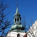
Lemvig is an attractive little town in idyllic surroundings. The district has long been noted for its rich cultural life, which has been created by artists, sculptors, poets and is well worth a visit - there is much to see! aerial pictures
The history of the airfield
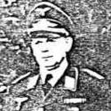
A few days after the occupation of Denmark, the local Danish authorities were informed by the Germans that an airfield was to be established on an approx. 600 ha. area to the south of Rom church.
Work started that year and by 1941, the grass airstrips, the concrete taxiways, the dispersal bays, the ammunition and fuel depots and the anti-aircraft defences had taken form. The 43 concrete bunkers were built in 1943 and 1944.Taxiways, machinegun bunkers, bunkers for the personel etc. can still be seen in the vicinity.
The airfield came to serve as a reserve airfield to the somewhat larger airfield in Grove, which was established in 1942 and which is now known as Karup Airport.
The hospital bunker lies a few hundred meters to the west of the present airfield. It was built in 1943-1944 and was the largest with in all 21 rooms on two levels. It was intended to be used in the event of hostilities in the area so never came into service. Lights have been installed and informative posters describing the airfield area during and after the second world war have been hung up.
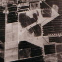
Dispersion bay
The airfield 1940-45
Action radius
A copy of the German airforce´s map is available here